How to transform drawing from one coordinate system to another in AutoCAD Map 3D and Civil 3D

Autodesk Support

Feb 21, 2025


Products and versions covered


Issue:

How to transform drawing objects defined in one coordinate system to a different coordinate system in AutoCAD Map 3D and Civil 3D.
 

Causes:

Causes may include:
  • Consolidation of data spread across different coordinate systems.
  • Coordinate system of the project has changed and drawings need to be updated.

Solution:

  1. Open the existing drawing.
  2. Assign the current/defined coordinate system to the drawing using MAPCSASSIGN command.
  3. Save the drawing.
  4. Create a new drawing from template.
  5. Assign the target/desired coordinate system using MAPCSASSIGN command.
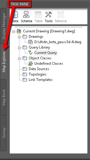
  6. Open Task Pane via command MAPWSPACE.
  7. Open Tab Map Explorer.
User-added image
  1. Attach the drawing above with the output coordinate system using drag & drop from Windows Explorer to Task Pane. Alternatively, right-click on Drawings > Attach and browse to the desired file.
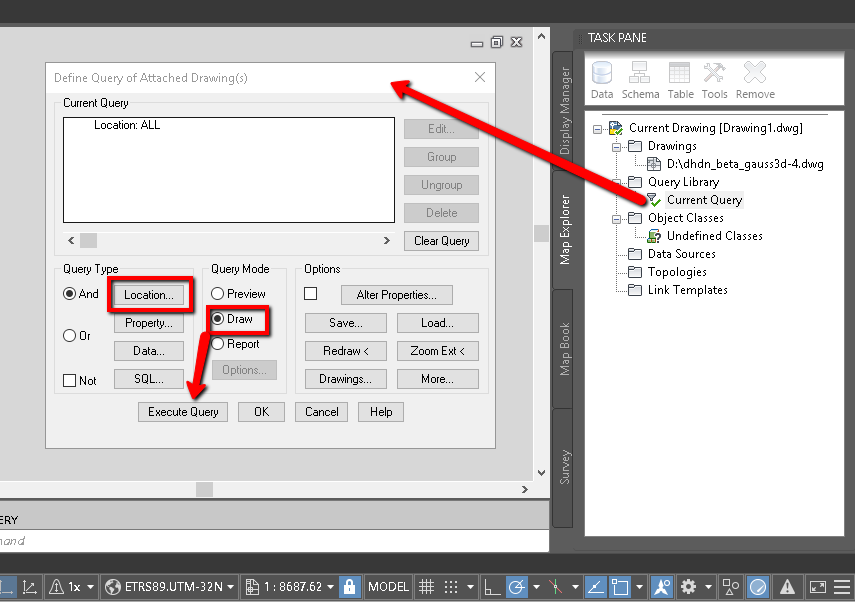
  2. Create a Query with Location = All and Query mode = Draw 
User-added image
  1. Execute Query to insert the queried objects in the new drawing and transform to the current drawing coordinate system.
       9. Right-click and Detach the source drawing from Task Pane > Map Explorer, then save the current drawing.

Note:

Products:

Civil 3D; AutoCAD Map 3D;


Was this information helpful?


Need help? Ask the Autodesk Assistant!

The Assistant can help you find answers or contact an agent.


What level of support do you have?

Different subscription plans provide distinct categories of support. Find out the level of support for your plan.

View levels of support